In my analysis, the Tibetan National Identity is defined by Mother Nature and not by mere interpretation of the history of its people or by the history of foreign dynasties that conquered Tibet.
I ask my readers to give attention to the Natural Factors, Natural Conditions, Natural Causes, and Natural Mechanisms that work together to generate the experience unique to the Tibetan Nation.

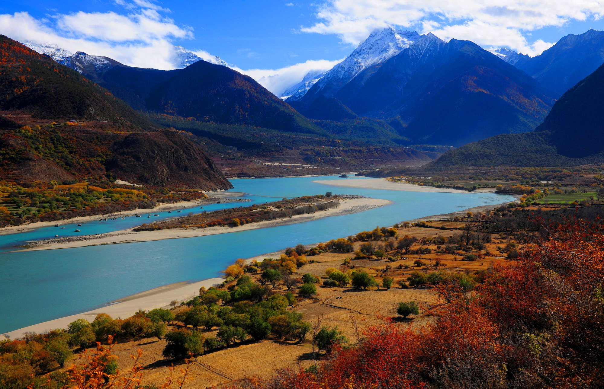
Adventurers call Tibet’s Yarlung Tsangpo the “Everest of Rivers” for good reason. Stretches of it are some of the least-explored places in the world, and tales of failed expeditions abound. With headwaters in western Tibet near Mount Kailash, the river has the highest average elevation—4,000 meters (13,000 feet)—of any major river in the world.
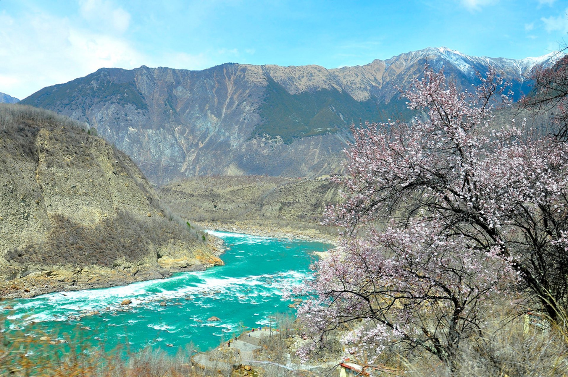
For much of the river’s 3,000 kilometers (1,800 miles) course, it flows east through open valleys on the Tibetan Plateau. But at the eastern end of the Himalayas in southeastern Tibet, the river bends sharply, rushes through one of the most dramatic gorges in the world, and descends to the lowlands of the Ganges Delta.
The Yarlung Tsangpo gorge is defined by superlatives. Carved into granitic bedrock, it reaches more than 5,300 meters (17,000 feet) from top to bottom in some places, making it three times deeper than the Grand Canyon. It’s also one of the world’s longest canyons, stretching more than 500 kilometers (300 miles).
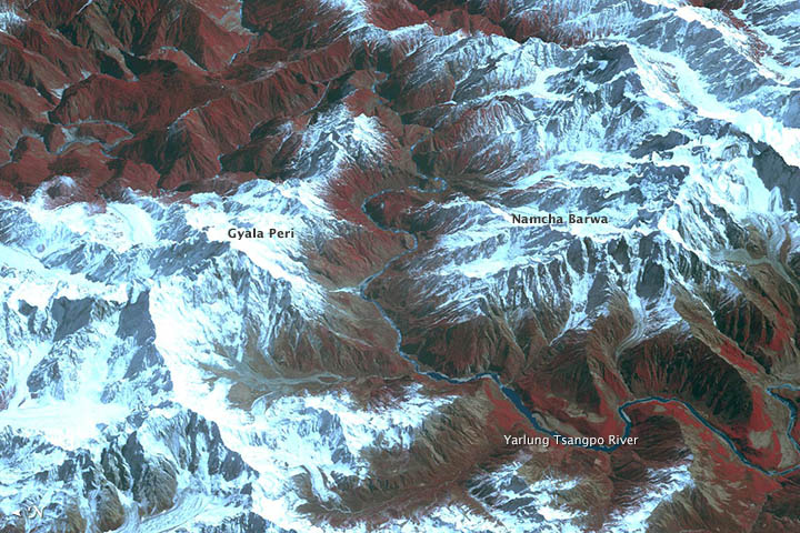
The first image above shows one of the most inaccessible and rugged sections, a part near the canyon entrance where the river passes between two major peaks: the 7,782-meter (25,446-foot) Namcha Barwa and the 7,294-meter (23,462-foot) Gyala Peri.
The first image above is a composite, draping a false-color view from February 25, 2004, over a three-dimensional model of the area. The images and stereoscopic data behind the model were acquired by the Advanced Thermal Emission and Reflection Radiometer (ASTER) on NASA’s Terra spacecraft. Vegetated areas range in color from red to pink; snow is white; water is black, and bare rock is earth-toned.